
As Super Typhoon Ragasa moved toward southern China, the Chinese city of Shenzhen began making plans to evacuate 400,000 people. At the same time, people in the northern Philippines were looking for cover from strong winds.
According to the Philippine weather office, the typhoon hit Calayan Island in the Babuyan chain, which is not very populated, at 3:00 pm (0700 GMT).
The national weather office said that as of 5:00 pm (0900 GMT), the storm’s center had sustained winds of 215 kilometers per hour (134 mph) and gusts of up to 295 kph.
“The wind was so powerful that it woke me awake. “It was hitting the windows, and it sounded like a machine that was turned on,” said Tirso Tugagao, who lives in Aparri, a seaside town in northern Cagayan province.
Herbert Singun, an information officer on Calayan Island, informed our reporter that pieces of a school roof had been ripped off and landed on an evacuation center about 30 meters (yards) away, causing one minor injury.
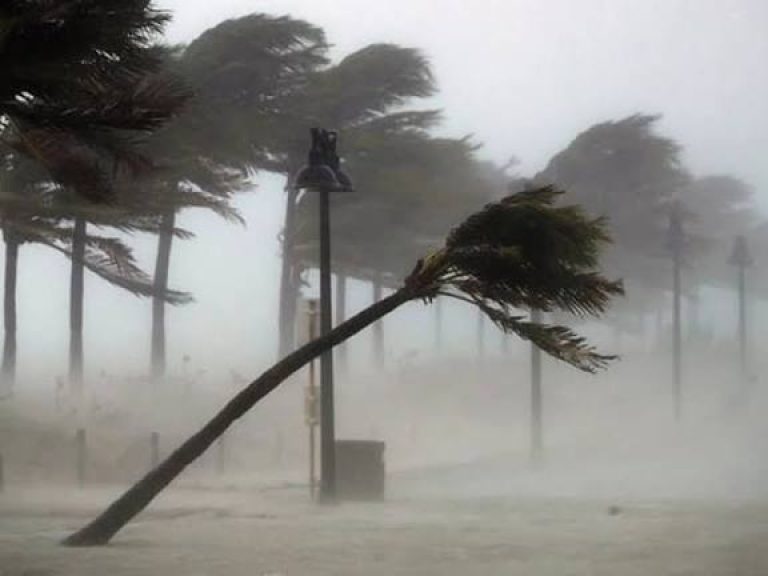
He inquired over video chat, “Can you see those coconut trees moving in the distance?”
“There used to be eight of them. There are only four left now. That shows how powerful this typhoon is.
Schools and government offices were shuttered in the Manila area and 29 other provinces on Monday. More than 10,000 Filipinos were evacuated from throughout the country.
Authorities in China’s Shenzhen indicated late yesterday that they planned to transfer hundreds of thousands of residents from coastal and low-lying areas. This will be a far bigger operation.
Because of the storm, many other cities in Guangdong province said that courses and work would be canceled and public transportation would be stopped.
Cathay Pacific, which is located in Hong Kong, said it would have to cancel more than 500 flights because Ragasa was threatening the financial hub.
A spokesperson for the airline said that passenger flights to and from Hong Kong International Airport would stop at 6:00 p.m. on Tuesday and start up again during the day on Thursday.
– “Very heavy” –
The state weather office in Taiwan said there was a potential of “extremely torrential rain” in the east of the country.
“About 320 kilometers is its storm radius. Even though the typhoon’s center is still a long way out, its large, strong wind field and outer circulation are already having an effect on sections of Taiwan.
James Wu, a firefighter from the area, informed our reporter that evacuations were still going on in the mountains near Pingtung.
He went on to say, “What worries us more is that the damage could be like what happened during Typhoon Koinu two years ago,” when utility poles fell and sheet-metal roofs flew into the air.
John Grender Almario, a meteorological expert for the Philippine government, said on Sunday that “severe flooding and landslides” were likely to happen in the northern parts of Luzon, the largest island.
Ragasa’s threat of flooding comes just a day after thousands of Filipinos came to the streets to protest a burgeoning corruption scandal involving flood control projects that were poorly built or never finished.
The Philippines is the first big piece of land in the Pacific cyclone belt. The archipelago gets an average of 20 storms and typhoons each year, which keeps millions of people in disaster-prone areas in a state of perpetual poverty.
Scientists say that storms are getting stronger because of climate change caused by people.